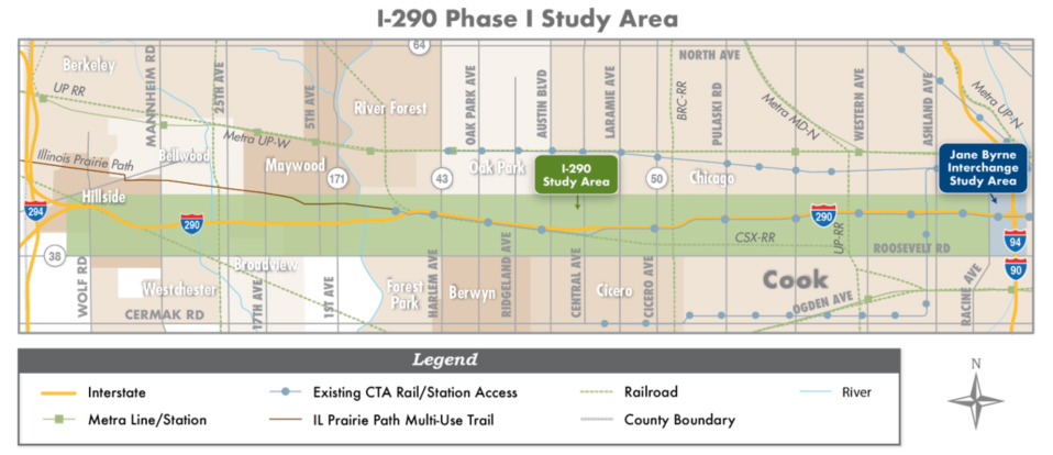
Location
The I-290 study area is located in Cook County and extends approximately thirteen miles centered along I-290 from the I-88 and I-290 split on the west to Racine Avenue on the east. This corridor passes through eight communities: Chicago, Bellwood, Broadview, Forest Park, Hillside, Maywood, Oak Park, and Westchester.
When the I-290 study began in the fall of 2009, the study area focused on the section of I-290 from Mannheim Road to Cicero Avenue. As the alternative’s evaluation process advanced, there was a need to extend the limits of the I-290 study four miles eastward to Racine Avenue for the Draft and Final Environmental Impact Statement.
View a larger version of the location map [250KB PDF]